Christian Hirt (Curtin University Perth, Western Australia, Technische Universität München, Deutschland) kutatóprofesszor látogatása és a vele készült interjú az MTA CSFK Geodéziai és Geofizikai Intézetben
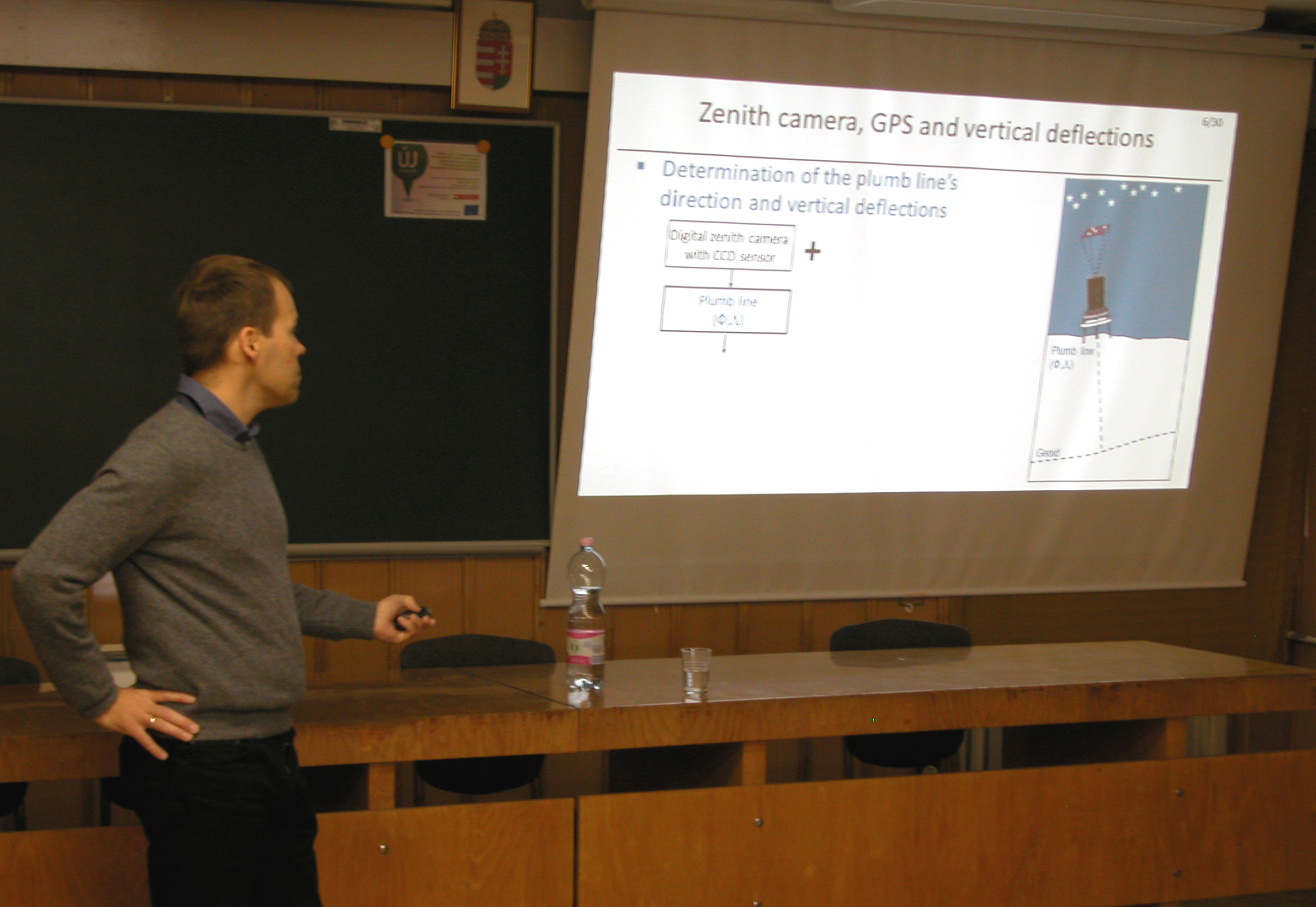
Az MTA CSFK GGI Gravitáció térben és időben Kutatócsoport tagjai, Papp Gábor, Szűcs Eszter és Benedek Judit november utolsó hetében asztrogeodéziai és más földi megfigyelési módszerek, mérőrendszerek témakörben finn, osztrák és német kollégák részvételével szakmai találkozót szerveztek a GGI-ben. A megbeszélések során egy nanoradián felbontású interferometrikus dőlésmérő soproni és ausztriai működtetéséről és egy új típusú zenitkamera kifejlesztésének elvi és technikai részleteiről is tárgyaltak. Az utóbbi témakör egyik nemzetközi hírű szakértője Christian Hirt professzor, akinek az „An astronomical-geodetic journey into high resolution gravity field modelling” c. előadása számos hasznos információval szolgált.
Az MTA CSFK-ban az MTA által támogatott GEO-DIN projekt egyik fontos eleme a zenitkamera fejlesztése, amelynek segítségével egy felszíni pontban nagy pontossággal (±0.1 szögmásodperc) meghatározható az ún. függővonal-elhajlás, vagyis a geodéziai vonatkozási rendszer alapjául szolgáló forgási ellipszoid és a ponton átmenő valódi potenciál-felület normálisai közötti szögeltérés. A függővonal-elhajlások alapján kiszámítható a magassági rendszer alapfelületéül szolgáló ún. asztrogeodéziai geoid, amely összevethető pl. a gravimetriai, vagy a GPS és a szintezési adatok kombinálásával előállított geoid variánsokkal.
A különböző megoldások között jelenleg még szub-deciméteres szisztematikus és néhány centiméternyi nagyságú “véletlenszerű” eltérések mutatkoznak, de az összehasonlítások alapján pontosítható az a “hivatalos” geoid felület, amely a GNSS (pl. GPS) navigációs magasság-meghatározásának sarkalatos eleme, és amelynek megbízhatósága jelentősen befolyásolja a magassági koordináta megbízhatóságát. Az új asztrogeodéziai mérések a geoid finomszerkezetének geofizikai interpretálását is segíteni fogják, a gravimetriai mérésekkel kombinálva pedig lehetőséget biztosítanak az erőtér, mint vektortér leképezésére. Ez utóbbinak kulcsszerepe van az inerciális és műholdas navigáción alapuló erőtér térképezési rendszerek fejlesztésében, pontosságuk növelésében.
A Csillagászati Intézetben a Pál András vezette Légyszem-kamera Kutatócsoport által megépített ún. hexapod platform asztrogeodéziai alkalmazási lehetőségeinek felméréséhez és az érintett kutatócsoportok szakmai munkájának megismeréséhez nagymértékben hozzájárult a csillagász és geodéta szakemberek kétnapos (november 28-29.) soproni megbeszélése.
A Christian Hirt professzorral készült interjú alább olvasható.
Q: Professor Hirt, would you tell us some details about your educational and academic research background?
A: I am a geodesist and a senior university researcher. I have studied computer science and geodesy at University of Hannover, where I graduated and received a PhD for my research on an astronomical camera for gravity field determination. For the last couple of years, I have been working in Perth (Western Australia) at Curtin University on several aspects of physical geodesy and planetary geodesy. I am currently staying at TU Munich as a Hans-Fischer Fellow under a scheme supporting outstanding international research through German universities excellence initiative.
Q: Which are the main achievements of your research career?
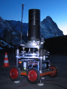
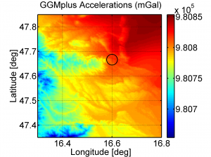
A: My first main achievement is certainly the development of a fully-automated zenith camera system with digital imaging technology. You can imagine this as a transportable, extremely sensitive star camera which can accurately sense the local variations of Earth’s gravity field, based on photography of the night sky. Over the past years I have moved on from instruments and observations to modelling, and have done some work on gravity field modelling with ultra-high resolution based on forward-computation of the field. These activities resulted in first-ever gravity field maps for Moon and Mars with km-resolution (in 2011 and 2012), and culminated in an extremely detailed map of Earth’s gravity field with
200 m resolution and near-global coverage of land areas. We released these under the name GGMplus in August 2013 to the public and received an encouraging feedback so far, including coverage in the magazine “New Scientist”.
High-resolution map of gravity accelerations over the Sopron area, from GGMplus (2013)
http://geodesy.curtin.edu.au/GGMplus/
Q: What is the purpose of your visit to Sopron?
A: I have visited Sopron because I received an invitation from the Hungarian Academy of Sciences (HAS) via the Geodetic and Geophysical Institute. My dear colleague Gábor Papp, whom I came to know some years ago through email contact on geodetic and geophysical research, approached me with plans on the construction of a digital zenith camera for Hungary. I followed the invitation because I was very interested to learn about the plans of my Hungarian colleagues, and I thought it is a good idea to share my knowledge in this field which I gained during and after my PhD studies. I found it very exciting to learn about the new, promising collaboration between astronomers and geodesists of the MTA and their novel approach to combine a hexapod platform with a digital star camera.
Q: What is the importance of the zenith camera developments and applications?
A: For modern research in physical geodesy, a cutting-edge digital zenith camera can open several new applications. Take Germany and Switzerland for example, where digital zenith cameras are now being used for over a decade. My fellow scientists including myself have used the cameras to strengthen the national geoid model (in Switzerland), which is pivotal for modern topographic mapping with satellite systems. In Germany, we have focussed on the validation of geoid models and height systems. Comparisons with geoid information from the zenith camera provided a valuable independent check on the height reference surfaces and showed that over local areas the German geoid models can reach a precision of a few millimetres, in a relative sense.
Accordingly, I think that the Hungarian zenith camera that is now under development may be helpful to verify and then improve the Hungarian height system. This will be important for cm-accurate height determination with satellite positioning systems, e.g., GPS, and also in the context of new systems such as the European Galileo system. The zenith camera may also prove beneficial for accurate gravity field determination at the national border, e.g., around the Neusiedler See, where problems with existing models were reported. Accurate zenith camera measurements contain valuable information on local mass-density anomalies, so may be used – along with gravimetry – to improve the knowledge of the upper Earth’s structure in the Carpathian-Pannonian region, which may be interesting for geophysics. I am very optimistic that the Hungarian geoscientists will make scientific contributions of international significance in these fields.
Q: Which are the most challenging scientific issues in geodesy?
A: There are many significant issues in modern geodesy, actually far too many to address them all, so I only mention a few related to the gravity field. The planned follow-up satellite missions for the measurement of Earth’s time-variable gravity field are of high significance for environmental sciences, far beyond the classical boundaries of geodesy. In high-resolution gravity modelling, we will now see efforts towards the development of ultra-high resolution models in spherical harmonics, with many open questions on modelling strategies and that remain to be answered by geodesists. Also the development of new marine gravity fields over the oceans from the non-repeat altimetry mission are ‘hot’ topics.


